Over the course of the past few months I’ve discovered my niche in the cycling world – Touring and this weekend only confirmed that. The first of many tours was really fun and good for the soul. Admittedly, I was quite nervous pre-ride and during the planning process as to how it would go mainly due to possible flats, etc. It was quite different than being around the DC area with paved trails and always available for a ride back home if suddenly something unexpected happen. I should probably point out the actual mileage was of not much concern, it was the actual packing of overnight gear, supplies and clothing selection. I had to be prepared for anything that happened and it felt good to depend on myself only. My map was my guide and my food the fuel. With close to 40lbs of gear I was in the saddle.
5/25: 70 mi | 7 hr 38 min | 1,175′ elevation gain
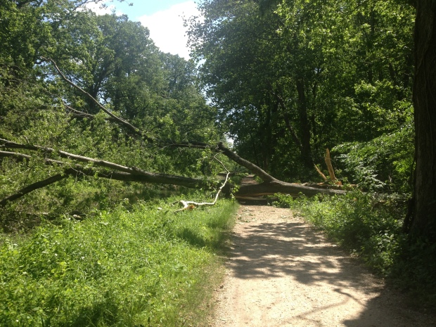
Day one was originally supposed to take me to Antietam but with low temps overnight and into the morning (because, you know it’s Memorial Day Weekend) and terrible allergies I cut back the trip and left at a later hour – 10am at 53F. The previous 2 days of heavy rain was also a worry of mine but was made clear to me through various avenues that the trail was still fine to travel on. Clothes of choice was cycling tights and Pearl Izumi Windjacket. The first hour was very oddly the hardest part of the whole trip. To make my way to the actual trail I had to climb steep hills and traffic via Williamsburg St in Falls Church into Arlington to cross the river at Chain Bridge. Just before Chain Bridge, I encountered a trail off Military Rd that closely resembled a ravine. The trail was so steep I hopped off the bike and gingerly walked (because of the bike weight and on slick bike shoes) down the hill about 100 yards to the bridge head. Once on the actual trail, the tough part was over it turned out. What initially was an empty trail gave way to massive crowds at Great Falls, MD. I made my way through the crowds and once past the crowds turned to none but quickly came up to a fallen double tree where I had to lift the bike with all its weight over. One of the many things I was prepared to come across. Really only after the 20mi mark was the trail my own and smooth riding transpired where I just took off my helmet (hurts my neck after a while) and rode on.
The next segments and lock sections of the trail were a blur and what seemed to be the exact same until getting to River Rd ahead of White’s Ferry, detouring there for an actual road and a break from the trail. What was supposed to be a break from the trail turned out to add even more time to the trip. 30mi+ headwind ensued over this 5mi stretch with sharper gravel and dusty dump trucks and bull dozers to boot. I even had to stop to let some go past me while I turned the other way to not get dust in my eyes and lungs than was on the trail. Maybe on a less windy day I will try again. Once, back on the trail more of the same until outside of Dickerson, MD where a busy railroad provided a change of scenery and action. Turns out, the MARC train at Brunswick and freight trains frequent here constantly. I should point out as well, from 45mi mark onto Brunswick the trail appeared to not be able to hold as much water as previous miles had. Just before Brunswick, I encountered the trail being shared by motorcoaches and the dodging of “gravel basins” ensued thanks to vehicle traffic. Once past, the campground at Brunswick the trail led to its old self until finally arriving in Harpers Ferry. At points, the trail seemed such the same, I decided to use some battery life to play some “Trampled By Turtles” radio on Pandora, making this particular stretch a little more interesting.
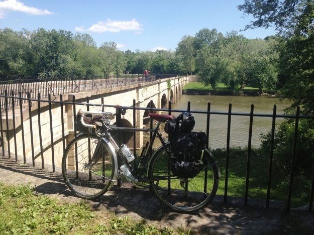
Monocacy Aqueduct, Dickerson MD
I didn’t see anything written about this but if you go to the town via bike you have to carry your bike up the stairs of the train track bridge which leads into the town. I took off my bike shoes and switched to my NB Minimus shoes for this due to the metal slits in the stairs. Over breakfast in the morning I would come to find out a lot of first time Asian visitors to this great nation were extremely nervous about being on the bridge and refused to budge for some bikers just walking their bike across. Don’t mean to offend, but thought this was comical.
Just Outside Dickerson, MD
*No Sound*
Once across, I made my way to the Tea Horse Hostel where I discovered that Laurel (the hostel owner) had made sure I was coming still, out of breath due to the Washington St climb I told her yes. Note: Be prepared to walk up this hill or take the flatter route of Shenandoah St to get to the hostel. I was a little lost and because I didn’t want to traverse down the steep hill of Washington St again I asked for directions from multiple people for the hostel just to double check. Turns out no one in this small Civil War town knew where the Hostel was which turned out to be hilarious because one of the folks who I asked, he was running for mayor that lived in the nicest house in town lived two extremely small blocks from the hostel. Not sure who was more of an idiot – him or I. After checking in, I had a single bed but sharing the room with a couple from PA. Most of the folks here were hikers coming from the Appalachian Trail. Did you know that each hiker has their own nickname? A couple of the names were Newdeenie (because he had a new knee replaced) and ZZ Topless (because he hiked without a shirt on). Newdeenie was going to take my bunk if I didn’t show but he instead slept on the floor on his mat, he said “Oh, I’m fine, I’m right at home on the floor, been sleeping this way for years.” I didn’t feel too bad about it.
The Tea Horse has a locked shed for the bikes but somehow (and because I was near the lobby) I was able to be the only one to keep the bike inside. Laurel really liked the fenders and Crane bell. Once settled, I ate dinner at Anvils a couple blocks down with a couple of beers and took a nice shower. I had to wait for the shower but that left me time to write some notes down about the ride up, surprisingly I wasn’t too worn out which I was proud to have happen that shows my stamina is improving. I should also point out that most of the folks that were here were young and educated folks doing the same things such as I and mostly from DC. It was a surprised welcomed. If you’re nervous about hostels I wouldn’t be about this one because if you lived in a somewhat OK dorm in college you’ll be fine. Another funny thing about HP – the official Post Office/Police Department/Main Liquor Store all share the same building. Why not? Other thing was the Episcopal church several blocks down had open for consumption “Living Water” for the hikers. I almost went to church the next morning because checkout was at 9am but I don’t think anyone wanted to see someone with cycling gear darken their front door.
5/26: 52 mi | 5 hr | 1,230′ elevation gain
Day two started with a terrific breakfast of Belgian Waffles made to order, fresh cut fruit, OJ & coffee provided by the hostel – for $33 per bunk this place was no joke, FAR better than a Hampton Inn. Over breakfast, I got to know some folks from DC as well as my bunk mates from PA. Turns out most were riding converted road bikes and riding skinny tires. Whatever works… After breakfast, Laurel wished me farewell and I was off again a midst church bell rings and to cross the Potomac and Shenandoah once again. I made my way to Brunswick, MD where I strapped my helmet on and put the flashers on to make my way over the bridge into VA. Turns out the bridge was vacant on the Sunday morning and I took the lane pretty much the whole way cross, where I eventually made my way to Wenner Rd.
The map below shows how I took a shortcut from Brunswick to the W&OD trail.
Day two was shorter due to the C&O honestly being so boring the first day (apologies to people who love biking this by themselves). A fellow cyclist is priority on the C&O for many reasons and this is a main one I found out. Once on the VA back roads I meandered through steep gravel climbs and descents while bordering Catoctin Creek ’till eventually made way back to a paved road – Loyalty Rd at Taylorstown, VA. There is very nice farmland here with vista views to the mountains in the east. Loyalty Rd turned into Clarks Gap Rd where the traffic was borderline dangerous but I eventually made my way back via Paeonian Springs and onto the W&OD for lunch and a break at a rest structure.
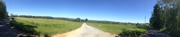
Downey Mill Rd.
Credit to @colintbrowne for this route. At the rest overhang, I must’ve looked beat because folks were asking me where I was coming from and my destination. An older woman with her grandkids were among some of the curious folks and her incessant talking of times gone by, “…remember when I used to ride the electric car near Shirlington..” Impatient looks by the kids abound led me to feel the pressure of abruptly ending the conversation. Mission accomplished.
Catoctin Creek Section
*No Sound*
W&OD was the W&OD but had a stiff tailwind which made me zip by the grandma who was actually leading the pack by a long shot. Outside of Leesburg, VA I stopped in a local cyclists hot spot – Carolina Bros BBQ where I had a sandwich. First time visitor but really good food. A surprise occurred when I saw Brook (@velowanderingdc) and Michael, two DC cyclists when I was about to leave. Ended up riding back with them to complete the trip.
Originally, this trip was going to allow me to finally do a century ride but I found out it was much more important to experience the journey instead post a number. I think cyclists, with me included, focus in on this a little too much at times. Ultimately, the challenge of relying on cue sheets, packed gear and food and meeting great people along the way were the parts most memorable. I look forward to the next tour, most likely completing the C&O to Cumberland and one day to Pittsburgh, PA. I hear the GAP Trail has nicer gravel. I do believe a front rack that will accept panniers would help but that’s not something I’d like to invest in right now. Meanwhile, M.E. has already volunteered to pick me up in Cumberland, MD :) Such a good wife. I’d prefer not to go alone though!
See all my 42 photos here. Taken with iPhone. http://www.flickr.com/photos/89311919@N02/sets/72157633728918866/
Additional notes for those who are planning a trip on the canal and are curious:
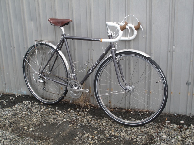
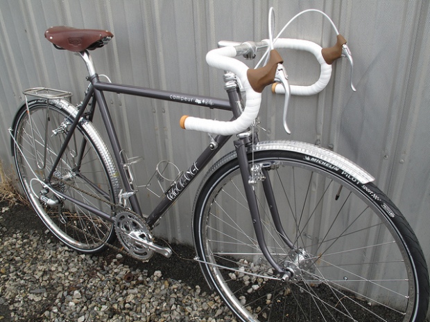
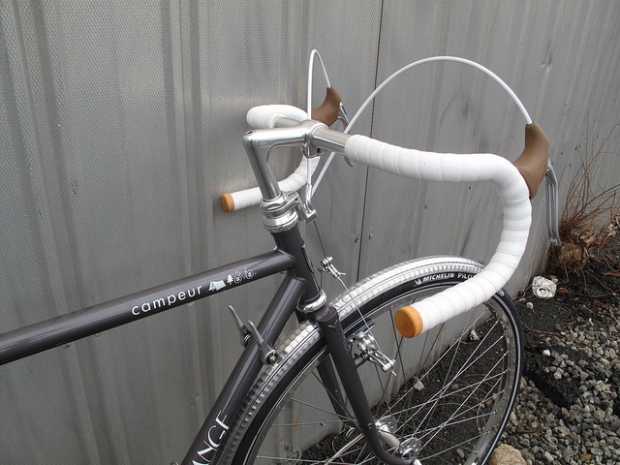
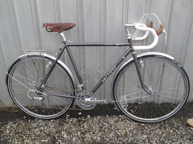
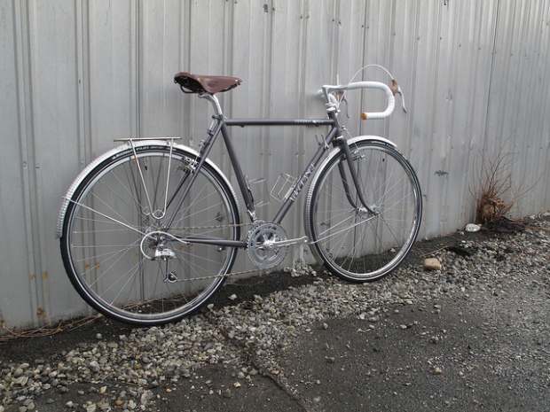
I traveled on 32mm (really 33mm) Michelin Pilot Sport Tires, Honjo Fenders, 2 Full Axiom Panniers, Full Ostrich Handlebar bag, 1 VO saddlebag.
Gravel Sections To Note
- Before and after Great Falls was regular C&O gravel – that being dirt slash rounded light gravel. During GF the gravel was a little sharper
- Near Brunswick Campground was a little sharper, as you get a mile or so from HP the same applies
- Basically, wherever there are crowds is where you should pay attention to any mogul rocks on the trail
Trail Holding Up to the Rain
- The rain a couple days previous was of concern to me and I know a lot of folks don’t trust the trails ability to hold rain and quickly dry. What helped this particular situation was the high amount of wind sustained for the previous 24 hours which greatly helped. I know this because I used to help out with golf greens. Yes, Creeping Bentgrass can wilt due to access wind at a certain temperature. The trail from what it looks like below can wick away some rain. I did not once find a section where I could not pass. There was always a route around a low depression which was holding moisture. The stats along the trail locations:
- DC 2 days out .17” 1 day out .01”
- Dulles Airport 2 days .49” out Trace 1 day out
- Hagerstown, MD 2 days out .05 Trace 1 day out
- I couldn’t get stats from in between Hagerstown line and Dulles, couldn’t find anything but I will tell you these echoed the Dulles location stats. The trail was fine in these locations
- Little insight at least to HP – An amazing thing to me was that every single depression I came to, the way to travel around it was to go to the left (going west on the trail) and you could navigate around the wet parts. I took this as the whole canal leaning slightly toward the historic canal bed (to the right). So be prepared to travel to the left, again at least until Harpers Ferry. It’s not like there is any traffic along the path to contend with.